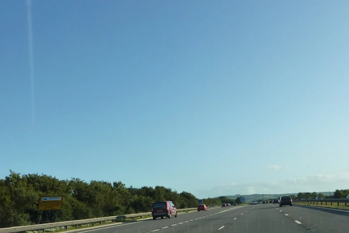

Nailsea's Link Road is one-way until late November, the M5 southbound shuts at junction 21 overnight to 2 October, and Worle High Street works start 5 October.
Three things change on North Somerset’s roads this week and next. Link Road in Nailsea is one-way from Monday 28 September, until late November. The M5 southbound closes through junction 21 overnight from Monday 28 September to the early hours of Friday 2 October. And Worle High Street works start on Monday 5 October, with The Scaurs and Ebdon Road going one-way the same day.
The weekend M5 closures are over. The southbound carriageway was shut between junctions 19 and 22 on the nights of 25, 26 and 27 September, and the last of them ended at 6am on Monday 28 September. That was the final full closure National Highways has published for the St Georges Bridge scheme.
Last checked 28 September 2026.
Closed right now
- Link Road, Nailsea: one-way from Monday 28 September until late November, running from the Waitrose junction towards the High Street. The left turn from the High Street into Link Road is closed, and drivers carry on to the Brockway roundabout. Cyclists keep two-way access. Buses that normally use Link Road are diverted via Stock Way North, with temporary stops and information boards. The work replaces the town’s main bus shelter, fills in the layby opposite the Italian restaurant, removes the unused stop outside the Waitrose car park and resurfaces the High Street at the Link Road end (North Somerset Council).
- Strawberry Line, Winscombe and Axbridge: phase 2 of the ash dieback felling closes the line on weekdays from Monday 28 September to Friday 9 October, from the A38 to Winscombe Sports and Social Club. There is no access through or over a closed section during working hours. The line stays open at weekends (North Somerset Council).
- M5 at junction 21: three narrow lanes, a 50mph limit and average speed cameras, 24 hours a day, in both directions. Detail below.
- Underbanks, Pill: closed 20 August to 29 October for a drainage upgrade tied to the railway rebuild. Four-way lights are also running on Lodway while the bus stop, road and pavements are improved (Network Rail).
- Sheepway bridge, Portishead: closed to all traffic and pedestrians until autumn 2026. Buses do not run along Sheepway.
- Harbour Road, Portishead: one-way until autumn 2026, towards the roundabout from Newfoundland Way only.
- Old Street and Kenn Road, Clevedon: town centre works to the end of 2026, with traffic sent round the right-hand side of the clocktower. We covered what changes in Clevedon separately.
- Nutwell Road, Greenwood Road and Martins Grove junctions, Worle: work started in the summer holidays and the council now says it will be finished during the October half-term (North Somerset Council, 23 September).
- Hildesheim Bridge, Francis Fox Roundabout, Weston-super-Mare: a new signal-controlled Puffin crossing between the railway station and the town centre, programmed from 14 September to mid-October. Lane closures run 9.30am to 3.30pm, Monday to Friday, outside the peaks, with a small number of overnight closures in the final phase for surfacing and road markings. Signed diversions go via Locking Road and Drove Road (North Somerset Council).
- Lovelinch Gardens, Long Ashton: a bus shelter, real-time displays, dropped kerbs, an infilled lay-by and a realigned footway, from 1 September to mid-October. Access to all properties is maintained (North Somerset Council).
- High Street, Yatton: works to early October for a replacement bus shelter at the precinct, a new shelter near Atlay Court, footway resurfacing outside the precinct and real-time bus displays, plus cycle hoops at the Woodhill bus stop (North Somerset Council).
- Main Road, Cleeve: works to early December. The speed limit through the middle of the village drops from 40mph to 30mph, with a gateway feature and refuge crossing on Rhodyate Hill, new shelters near Warner Close, Cleeve Garden Centre and Brockley Stores, and double yellow lines on Bishops Road (North Somerset Council).
Starting in the next fortnight
- M5 southbound, junction 21: the carriageway between the exit and entry slips closes overnight, 10pm to 6am, on the nights of Monday 28 September to Thursday 1 October. The last closure ends at 6am on Friday 2 October. Southbound traffic leaves at the junction 21 exit slip and rejoins straight away on the junction 21 entry slip (National Highways closure report, week from 25 September).
- Worle High Street: works run from Monday 5 October to spring 2027. The Scaurs becomes one-way northbound and Ebdon Road one-way southbound from 5 October. The scheme brings a 20mph limit on the High Street and surrounding roads, new crossings including one on Station Road, wider footways, new bus shelters and a repaved Maltings precinct. The contractor runs a drop-in centre every Wednesday, 8am to 4pm, at the site compound near Queensway and Walford Avenue (North Somerset Council, 23 September).
- Strawberry Line phase 3: Monday 2 to Friday 13 November, Lynch Road bridge to Woodborough Road bridge in Winscombe. Not in the next fortnight, but it is the next closure on the route.
East Street and Towerhead Road in Banwell reopened on Friday 28 August, five weeks after closing for bypass work, as the closure notice advertised. Services 126 and U2 are back on their normal routes (First Bus).
The M5 at junction 21: where the bridge work has got to
The motorway is open during the day. What drivers now meet at junction 21, 24 hours a day:
- a 50mph limit with average speed cameras, live since 10pm on Thursday 3 September
- three narrow lanes northbound, from 19 September
- three narrow lanes southbound, from 26 September according to National Highways’ scheme page
- CCTV enforcement and a free vehicle recovery service, so a breakdown does not block a lane
The overnight full closures have finished. National Highways ran them in two blocks, 10pm to 6am, with diversions along the A370, A38 and A4 Bristol Portway:
| Nights | Closed | Diversion |
|---|---|---|
| Fri 18, Sat 19 and Sun 20 Sep | M5 northbound, J22 to J20 | Out at J22, the A38 and A4174, briefly the A370, then the A4 Bristol Portway, back on at J18 |
| Fri 25, Sat 26 and Sun 27 Sep | M5 southbound, J19 to J22 | Out at J18, the A4 Bristol Portway, then the A370, briefly the A4174, then the A38, back on at J22 |
The scheme page gives the closure blocks as “Friday 18 to Sunday 20” and “Friday 25 to Sunday 27”. National Highways’ daily closure reports listed each block on three separate nights, the last running to 6am on the Monday. The table follows the closure reports.
What comes next is not yet published. The scheme page, still carrying its update of 24 August, says only that overnight working runs “until Sunday 27 September”, and that the next stage is strengthening and resurfacing the road, then drainage work in the central reservation. The southbound closure between the junction 21 slips this week comes from the closure report, not the scheme page. We will add the next phase when National Highways publishes it.
National Highways also warns that North Somerset Council’s junction improvements on Queensway and the B3440 are running at the same time and may add to congestion around Worle. Worle High Street, which starts on 5 October, sits right next to them.
The scheme started in summer 2024. National Highways gives it an end date of 2030, and the published cost is still listed as to be confirmed.
The work itself is substantial: structural concrete repairs, 72 bridge bearings replaced, 18 steel beams under the bridge repainted, a new road surface, waterproofing and new barriers. The northbound entry slip also gets a second lane onto the motorway, which should help the merge at Weston in the long run.
The Strawberry Line closures in full
The council is felling ash trees killed by ash dieback along the walking and cycling route. Its cabinet member for sustainable places, Councillor Mark Canniford, says the disease “may affect up to 90% of ash trees in Great Britain”. Closures are weekdays only and the line stays open at weekends. Diversions are signposted where possible, but the council warns they use parts of the local road network and “may not be suitable for all users”.
| Phase | Dates | Section closed |
|---|---|---|
| 1 | Tue 1 to Fri 18 Sep, finished | A38 to Winscombe Sports and Social Club (work between the A38 and the tunnel near Axbridge) |
| 2 | Mon 28 Sep to Fri 9 Oct, running now | A38 to Winscombe Sports and Social Club (work between the tunnel and the club) |
| 3 | Mon 2 to Fri 13 Nov | Lynch Road bridge to Woodborough Road bridge, Winscombe |
Diversions will be signposted where possible, but the council warns they use parts of the local road network and “may not be suitable for all users”. Contractors will reopen sections early where the work allows.
Also worth knowing
- The X10 was extended to upper Clevedon on Sunday 30 August (North Somerset Council).
- Milton Park School Street is now built and in force in term time. Milton Park Road and Clarkson Avenue are restricted to authorised vehicles only, Monday to Friday, 8.15am to 9.15am and 3pm to 4pm.
Check before you drive
- North Somerset Council’s roadworks map shows current and planned works across the district, searchable by postcode, road name, town or village. The council aims to publish its own works at least two weeks in advance.
- National Highways for the M5 itself, which is not the council’s road.
- Traffic England for live motorway incidents and cameras between junctions 18 and 22.
Banwell bypass
The bypass is the biggest road scheme in North Somerset for decades. It takes the route between the A38 and Weston-super-Mare around the north of Banwell village, which has been a pinch point for years, and it also unlocks the 3,300-home Wolvershill development in the Local Plan.
It is mainly funded by Homes England through the Housing Infrastructure Fund. The original £66m budget did not survive the original contractor withdrawing and three years of construction inflation, and the figure is now around £105m, with Galliford Try building it.
The council’s published programme:
| Stage | Date |
|---|---|
| New Moor Road link | April 2026 |
| Banwell Bridge | Summer 2026 |
| Southern link | Early 2027 |
| Bypass opens | Spring 2027 |
| Full completion | Summer 2027 |
Work on site at the moment includes piling, the river bridge abutments, concrete pours for culverts and mammal passages under the new road. Traffic management appears and disappears at short notice around Banwell, Sandford, Churchill and Winscombe, and the council directs residents to the contractor’s own channels for the week-by-week detail. The scheme also includes walking, cycling and horse riding routes and a biodiversity net gain of over 40%.
The East Street closure that ended on 28 August was part of this work. The council originally programmed it for ten weeks, cut it to five and moved it into the school holidays so the diversion through Worle would not collide with the Queensway and Wolvershill Road Bridge works. That is also why the main Worle High Street scheme slipped; it now starts on 5 October. The council’s own announcement said six weeks in one paragraph and five in the next; the closure as advertised by the bus operator ran 27 July to 28 August, which is five weeks.
The Portishead railway works
Rebuilding the Portishead line means three miles of new track, two new stations and a great deal of disruption in Portishead and Pill until 2028. The position as Network Rail states it:
- Sheepway bridge is closed to all traffic and pedestrians until autumn 2026 while it is strengthened. Buses do not run along Sheepway and the stops at Conference Close, Portishead Ecology Park and Shipway Farm are suspended. A shuttle bus runs every 20 minutes, 8am to 5pm Monday to Friday, between Elm Tree Farm on Station Road, a temporary stop on Wyndham Way near the Sheepway roundabout, and Sainsbury’s.
- National Cycle Route 26 is diverted via Quays Avenue, Phoenix Way and the Ecology Park for the duration.
- Harbour Road in Portishead is one-way until autumn 2026, with traffic only able to travel towards the roundabout from Newfoundland Way. A new Quays Avenue and roundabout are being built to make room for the station; the new layout on Quays Avenue keeps two-way traffic.
- At Pill, the cuttings beside the railway are being excavated for the new platform and the soil reinforced with more than 2,000 steel rods, due to finish by the end of 2026. Underbanks is closed from 20 August to 29 October for a drainage upgrade, and four-way lights are running on Lodway. The main compound at Lodway Farm, opposite the Hammer and Spanner sculpture, is in full use by November. The right of way between Marsh Lane bridge and the Hammer and Spanner sculpture is suspended until the work finishes in spring 2028, because it is being used as a haul road.
Passenger services are due to start in 2028, hourly to Bristol Temple Meads in about 25 minutes. More on that on our train times page.
The M5 and the key routes
Four roads carry most of the district’s traffic and are worth knowing by name:
- A370, Bristol to Weston-super-Mare via Backwell, Congresbury and Worle. The spine of the district and the road that jams first.
- A369, Portishead to Bristol over Rownham Hill. This is the Portishead commute, and the X4 bus uses it.
- A38, along the eastern edge past Bristol Airport, Churchill and Sidcot. The Banwell bypass connects to it.
- A371 and A368, the Weston to Banwell and Weston to Churchill routes through the Mendip fringe villages.
Roads that cannot be dug up
This is the most useful and least known piece of council data. After a road has been substantially reconstructed, the council can impose a Section 58 restriction that bans further street works on it for up to three years, except in an emergency. If you want to know whether a road near you is likely to be closed again soon, the register tells you.
The August 2026 register lists 178 restrictions, 55 of them currently in force. Recent additions include the whole of Bridgwater Road in Long Ashton (in force from 3 August 2026 to 2 August 2029), Bristol Road and West Wick in Weston-super-Mare (8 June 2026 to 7 June 2029), Heywood Road in Pill (to May 2029) and Stuart Road in Weston (to February 2029). Proposed restrictions cover Westfield Road and Moorfield Road in Backwell from 4 August 2026, and four Clevedon roads (Lower Queens Road, Pizey Avenue, Old Church Road and Elton Road) from 14 September 2026.
The full list, with start and end dates for every street, is published as a PDF on the council’s substantial roadworks page.
Parking, town by town
All prices below are the council’s own, taken from its car park pages.
Weston-super-Mare
- Marine Parade, 443 bays on the seafront: peak season (2 March to 31 October) £3.50 for two hours, £7.00 for four, £12.00 all day. Low season £4.00 all day. The seafront gates are locked by the rangers roughly 15 minutes before the end of their shift, which is 6pm in winter and 10pm from May to September.
- Royal Sands, 1,000 spaces: peak £7.00 for four hours or £14.00 all day, low season £2.70 and £4.00. Open 8am to 9pm.
- Carlton Street multi-storey: £1.70 for an hour, £6.10 for four, £14.00 for 24 hours, £26.00 for a weekend ticket. The upper floors are currently closed; the council points drivers to the Sovereign Centre instead, which has more than 800 spaces at £1 for an hour up to £5 for 24 hours. Its hours have been extended to 11pm Sunday to Thursday and midnight on Friday and Saturday to cope.
- Locking Road long stay on Francis Fox Road, 325 spaces: £6.00 for 24 hours, £30.00 for a week. The cheapest way to leave a car near the station.
Clevedon
- Salthouse Fields, 144 spaces, 2.1m barrier: peak £1.60 an hour, £5.10 for four hours, £8.10 until 6pm. Low season £4.10 for the day. Coaches £10 in peak.
Portishead
- Lake Grounds Sea Front, Esplanade Road, 200 spaces: free.
Nailsea, Backwell and Worle
- Station Road, Nailsea, 230 spaces: £1 for two hours, £2.50 for three, £3.50 all day, charged 9am to 6pm Monday to Saturday.
- Nailsea and Backwell station, 271 spaces with 5 EV bays: 40p for 20 minutes, £3.60 for 24 hours, £5.20 for two days. Permits £250 for six months, £450 for twelve.
- Worle Parkway (Diamond Batch), 312 spaces: 40p for 20 minutes, £3.60 for 24 hours, £12.20 a week, £450 a year. Ten minutes free in the drop-off bay.
Winscombe
- Hillyfields Way, 51 spaces: free.
Blue badge holders get an hour free beyond the expiry of a purchased ticket in most council car parks. Most sites are paid through MiPermit rather than a machine.
Frequently asked questions
Are the M5 speed cameras at junction 21 switched on?
Yes. The 50mph limit and average speed cameras went live at 10pm on Thursday 3 September 2026 for the St Georges Bridge scheme, alongside CCTV enforcement and a free vehicle recovery service. They stay on for the rest of the rebuild. The motorway itself stays open during the day.
Is the M5 at Weston down to narrow lanes?
Yes, in both directions. Three narrow lanes have run northbound since 19 September and southbound since 26 September, 24 hours a day, at 50mph. The overnight full closures that came before them finished at 6am on Monday 28 September. The southbound carriageway between the junction 21 slips closes overnight from 28 September to 2 October; traffic comes off and straight back on at junction 21.
Is the Strawberry Line closed?
Yes, on weekdays. Phase 2 of the ash dieback felling closes the section from the A38 to Winscombe Sports and Social Club from 28 September to 9 October. It stays open at weekends. Lynch Road bridge to Woodborough Road bridge closes from 2 to 13 November for phase 3.
When do the Worle High Street works start?
Monday 5 October, running to spring 2027. The Scaurs becomes one-way northbound and Ebdon Road one-way southbound from the same day, and a 20mph limit comes in on the High Street and surrounding roads.
Why are there roadworks in Yatton and Cleeve?
Both are council bus improvement schemes that started on 14 September. Yatton’s High Street gets new shelters and real-time displays, due to finish in early October. Cleeve’s runs to early December and cuts the village speed limit from 40mph to 30mph.
What is happening at Hildesheim Bridge in Weston?
A new signal-controlled Puffin crossing is being built on Francis Fox Roundabout, between Weston railway station and the town centre. Work runs from 14 September to mid-October 2026, with lane closures from 9.30am to 3.30pm on weekdays and a few overnight closures at the end. Diversions go via Locking Road and Drove Road.
When will the Banwell bypass open?
The council’s published programme has the bypass opening in spring 2027, with full completion of all associated works in summer 2027. Earlier hopes of a 2026 opening were overtaken when the original contractor withdrew.
Why is Sheepway closed?
Sheepway bridge is being strengthened as part of the Portishead railway rebuild. It is closed to all traffic and pedestrians until autumn 2026, with a shuttle bus running every 20 minutes on weekdays between Elm Tree Farm, Wyndham Way and Sainsbury’s.
Where do I find current roadworks in North Somerset?
On the council’s own roadworks map, which covers current and planned works and is searchable by postcode or road name. For the M5 itself, use National Highways.
Which M5 junction is Weston-super-Mare?
Junction 21, then the A370 into the town. Junction 20 is Clevedon and junction 19 is Portishead.
Is parking free anywhere in North Somerset?
Yes. The Lake Grounds seafront car park in Portishead (200 spaces) and Hillyfields Way in Winscombe (51 spaces) are both free council car parks.
What is a Section 58 restriction?
A ban on street works in a recently reconstructed road, usually for up to three years, so a newly resurfaced road is not immediately dug up again. North Somerset publishes a register of every restricted street with its dates.
Sources
- National Highways: M5 St Georges bridge repairs, update of 24 August 2026, for the 3 September speed cameras, the September overnight closures and narrow lanes, the weeknight lane closures, the diversion routes, and the scheme’s works, cost and end date.
- National Highways travel updates and its daily closures page for anything that moves at short notice.
- North Somerset Council: Strawberry Line temporary closures, 26 August 2026, for the three felling phases and the closed sections.
- Network Rail: the Portishead Line for Sheepway, Harbour Road, Underbanks and the Pill diversions.
- First Bus: East Street, Banwell road closure for the closure dates and the 126 and U2 diversions.
- North Somerset Council: work to start on a safer crossing near Weston railway station, 2 September 2026, for the Hildesheim Bridge dates, lane closure hours and diversion routes.
- North Somerset Council: new transport improvements coming to Yatton, 7 September 2026, and transport improvements in Cleeve, 9 September 2026, for both schemes’ dates and contents.
- North Somerset Council: works to transform Worle High Street, 23 September 2026, for the 5 October start, the one-way changes and the Nutwell Road junction finish date.
- North Somerset Council: transport changes coming to Nailsea for the Link Road one-way and bus diversions.
- National Highways seven-day closure report, week from Friday 25 September 2026, for the southbound junction 19 to 22 nights and the junction 21 closures of 28 September to 2 October.
- Worle High Street programme revisions, Long Ashton transport facilities, Clevedon town centre works and Milton Park School Street for the council schemes and their dates.
- Banwell bypass: about the scheme and construction latest for the programme and current works.
- North Somerset Section 58 register, August 2026 for restricted streets.
- North Somerset car park locations for every tariff and capacity quoted.
- Carlton Street car park closure for the Sovereign Centre alternative and its extended hours.
Roadworks change daily. Check the council’s map and National Highways before you set off.
Have your say